Maximising Project Outcomes with Customised Aerial Imaging Strategies
Customised aerial imaging is changing how businesses tackle projects. You might be missing out on sharper insights and clearer visuals that can boost your project success. This post shows how tailored drone technology—from aerial photography to 3D modelling—can give you the edge in construction, real estate, and more. Read on to see how precise mapping services and construction monitoring redefine project results. Learn more.
Customised Aerial Imaging for Success

Curious about how customised aerial imaging can elevate your projects? It’s all about leveraging drone technology for better insights. From construction to real estate, tailored solutions are reshaping industries. Let’s explore how.
Tailored Solutions for Every Industry
Every business has unique needs. Customised aerial imaging offers solutions that fit your specific goals. Imagine having a tool that adapts to your project, whether you’re mapping a construction site or showcasing a property. This adaptability is why drone technology is the go-to choice for many industries.
Tailored solutions mean you get what you need, not a one-size-fits-all approach. In construction, precise aerial views can streamline planning. For real estate, stunning aerial shots make properties stand out. You start with a clear advantage.
It’s not just about images; it’s about insights. Industries like agriculture and surveying also benefit. They use drones for detailed land analysis and inspections. The possibilities are vast, and the results speak for themselves.
Benefits of Drone Technology
Drone technology brings numerous benefits to your projects. The key is in the details. With high-resolution imagery, you get a level of precision that traditional methods can’t match. This means better decisions and improved outcomes.
Think of the time you’ll save. Drones cover large areas quickly, delivering data in record time. This speed is crucial in fast-paced industries. Plus, the safety factor is a big win. Drones can access hard-to-reach places without putting anyone at risk.
From cost savings to enhanced safety, the benefits are clear. Drones are more than just flying cameras. They are tools that drive efficiency and innovation in your projects.
Applications in Key Sectors
Customised aerial imaging isn’t limited to one or two sectors. It’s a game-changer across various fields. Let’s look at how it’s making waves in key areas.
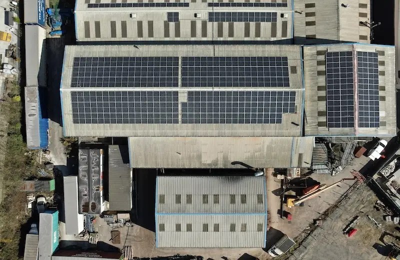
Enhancing Construction Monitoring
In construction, keeping projects on track is vital. That’s where drones come in. They provide detailed views of sites, helping you monitor progress and spot issues early. Imagine having a bird’s-eye view of your entire project at any time.
The benefits are clear. With aerial imaging, you can track materials, measure distances, and ensure quality control. It’s like having a virtual project manager in the sky. This approach not only saves time but also reduces costs by catching problems before they escalate.
Most people think ground inspections are enough, but drones offer a new perspective. They give you the full picture, helping you make informed decisions. The longer you wait to adopt this technology, the more you risk falling behind the competition.
Boosting Real Estate Listings
Real estate is all about first impressions. Aerial imagery can make properties shine. With stunning aerial shots, listings attract more attention and potential buyers. It’s a simple way to give your properties the edge they need.
Imagine a buyer scrolling through listings. Aerial photos showcase the property’s layout, surroundings, and unique features. This comprehensive view is something ground photos can’t provide. It’s a powerful tool for making properties irresistible.
Ready to enhance your listings? Explore strategic aerial photography approaches and see how they can transform your real estate business.
Advanced Mapping and Modelling

Moving beyond images, drones offer advanced mapping and modelling capabilities. These tools redefine how we understand space and structure.
Precision Mapping Services
Mapping services provide detailed topographic maps essential for planning. With drones, you get accurate and up-to-date data. This precision is invaluable for projects that require exact measurements.
Maps created from drone data are not just images; they’re comprehensive datasets. They help in planning infrastructure, managing resources, and even disaster response. When precision matters, drone mapping delivers.
Curious about how drones enhance surveying? Find out more in this insightful guide.
Creating Detailed 3D Models
3D modelling takes things a step further. Drones capture data to create lifelike models of structures and landscapes. This is perfect for architects, engineers, and planners who need a clear understanding of their projects.
With a 3D model, you can explore a virtual representation of your project. This aids in visualisation, communication, and decision-making. The impact is significant, offering a new way to interact with your projects.
Don’t miss out on the chance to integrate this cutting-edge technology into your work. The benefits of customised aerial imaging are too significant to ignore. Embrace the change and watch your projects soar to new heights.
😊