From Field to Site: How Real-time Drone Data Transforms Agriculture and Construction Workflows
Real-time drone data is reshaping how farms and construction sites operate across Ontario. You no longer need to wait days for survey results or struggle with outdated maps. With live insights from RTK drone mapping and multispectral analysis, your decisions become faster, more accurate, and backed by precise data. In this post, you’ll see how integrating real-time drone data boosts productivity while cutting risks and costs on your fields or sites. Learn more about the benefits of drones in construction and agriculture.
Real-time Drone Data in Agriculture
Agriculture in Ontario is evolving with the use of real-time drone data. This technology offers new ways to boost productivity and improve decision-making on the farm.
Precision Agriculture in Ontario
Precision agriculture relies on accurate information. Using drones, you can gather data quickly and efficiently. This means you can make informed choices about planting, watering, and harvesting.
-
Fast Data Collection: Drones collect data faster than traditional methods. You get real-time insights without delay.
-
Accurate Mapping: High-resolution images help you map fields with precision, ensuring better crop management.
In Ontario, farmers are embracing this technology to stay ahead. See how drone data integration can benefit agriculture.
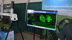
Crop Health and Multispectral Mapping
Monitoring crop health is crucial. Multispectral mapping allows you to see what the human eye cannot. This type of mapping can reveal crop stress and nutrient deficiencies early.
-
Early Detection: Identify issues before they become problems, saving time and resources.
-
Enhanced Analysis: With multispectral data, understand plant health at a deeper level.
Using these insights, farmers can act swiftly to protect their crops and maximise yield. Explore multispectral drone applications in agriculture.
Variable Rate Application Maps
Variable rate application maps help you apply resources efficiently. With drones, create maps that guide precise application of water, pesticides, and fertilisers.
-
Resource Efficiency: Use only what’s needed, where it’s needed, reducing waste.
-
Cost Savings: Save money by optimising input use, improving the bottom line.
This approach not only boosts productivity but also supports sustainable farming practices.
Enhancing Construction Workflows

Real-time drone data is making construction workflows smoother. It provides the tools needed for precise planning and efficient project management.
Construction Progress Monitoring
Keeping track of construction progress is vital. Drones offer a bird’s-eye view of the site, making it easy to see what’s happening.
-
Regular Updates: Get frequent updates without stepping foot on-site.
-
Detailed Visuals: See detailed images that highlight progress and potential issues.
With consistent monitoring, you can ensure projects stay on track. Learn how drones enhance construction monitoring.
RTK Drone Mapping and 3D Modelling
RTK drone mapping and 3D modelling are changing the way construction sites are managed. These tools provide precise measurements and detailed models for better planning.
-
Accurate Models: Create 3D models that reflect the real world accurately.
-
Improved Planning: Use models for site logistics and planning, reducing errors.
By integrating these technologies, construction teams can make more informed decisions. Find out more about integrating drone data into construction workflows.
GIS and BIM Integration
GIS and BIM integration using drones simplifies complex construction tasks. It combines geographical data with building information for enhanced clarity.
-
Data Integration: Seamlessly combine GIS and BIM data for comprehensive insights.
-
Enhanced Coordination: Improve team collaboration with shared, accurate data.
These integrations make managing construction projects more efficient, ensuring everything runs smoothly.
Operational and Financial Advantages

Real-time drone data provides both operational and financial benefits. It speeds up inspections, improves accuracy, and ensures compliance, ultimately saving time and money.
Speeding Decisions with UAV Inspections
UAV inspections allow you to make decisions faster. Quickly identify issues and address them before they escalate.
-
Quick Insights: Drones provide immediate visuals for rapid decision-making.
-
Reduced Downtime: Minimise delays by acting on drone data promptly.
This speed in decision-making is crucial in both agriculture and construction.
Accuracy in Cut and Fill Analysis
Cut and fill analysis requires precision. Drones offer accurate measurements, ensuring that earth-moving tasks are completed efficiently.
-
Precise Measurements: Ensure accuracy with drone-generated data.
-
Optimised Operations: Use data to streamline cut and fill tasks, saving resources.
This precision reduces errors and enhances project outcomes.
Reducing Risk with Transport Canada Compliant Operations
Operating drones in compliance with Transport Canada regulations reduces risks. It ensures safety and legality in all operations.
-
Safety Assurance: Conduct operations knowing they meet safety standards.
-
Regulatory Compliance: Avoid fines and legal issues by adhering to regulations.
By prioritising compliance, you protect your investments and ensure smooth operations.
Harnessing real-time drone data is a game-changer for agriculture and construction. It offers the tools needed for precision, efficiency, and safety, transforming workflows and boosting productivity. Embrace this technology to stay ahead and achieve greater success.