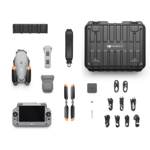
The Comprehensive Guide to Safe and Compliant Drone Survey Operations in Ontario
Drone survey operations in Ontario demand more than just flying skills—they require strict compliance with CARs Part IX and precise data capture to ensure safety and accuracy. If you’re managing agricultural lands, construction sites, or complex surveys, understanding these regulations is crucial to avoid costly delays. This guide breaks down everything you need to run RPAS missions confidently, from airspace authorisations to advanced mapping services, so you get reliable, regulation-ready results every time. For more insights, visit this comprehensive guide on drone surveying.
Ensuring RPAS Compliance in Ontario
Navigating the regulatory landscape in Ontario is essential for successful drone operations. Let’s explore how to ensure your operations comply with the rules, keeping your projects on track.
Understanding CARs Part IX Regulations
Getting familiar with CARs Part IX is your first step. This set of rules governs drone use in Canada, focusing on safety and accountability.
-
Safety First: These regulations ensure that your drone operations do not pose a risk to people or property. Always conduct a risk assessment before each flight.
-
Operational Compliance: Keep your drone registered and your pilot certificate up-to-date. This demonstrates your commitment to safety and compliance.
-
Record Keeping: Maintain detailed records of each flight, including date, time, and any incidents. This could be crucial in case of an audit.
For an in-depth look at RPAS regulations, check out this resource.
Navigating Transport Canada Advanced Operations
Operating at an advanced level opens up more possibilities but requires additional steps.
-
Certification: Ensure your pilot is certified for advanced operations. This involves passing a more rigorous test and demonstrating flying proficiency.
-
Site Surveys: Conducting pre-flight site surveys helps identify potential hazards and plan your flight path.
-
Operational Limits: Be aware of altitude restrictions and avoid controlled airspace unless you have the necessary permissions.
These steps ensure that your operations are compliant and safe. Learn more from this guide on advanced operations.
Securing NAV CANADA Airspace Authorisation
Operating in controlled airspace demands authorisation from NAV CANADA. It’s a process that ensures your flight is safe and coordinated with other airspace users.
-
Application Process: Begin your application well in advance. It can take time to process, especially for busy airspaces.
-
Flight Planning: Include detailed flight plans and contingency measures in your application. This shows you’re prepared for any situation.
-
Communication: Maintain constant communication with air traffic control during your flight. This keeps everyone informed and safe.
For a step-by-step guide on securing airspace authorisation, visit this link.
Precision and Safety in Drone Surveys
Precision and safety are at the heart of successful drone surveys. Let’s look at how you can ensure both in your operations.
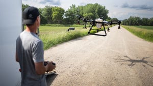
Implementing VLOS Operations and Safety Protocols
Visual Line of Sight (VLOS) is crucial for maintaining control over your drone.
-
Clear Line of Sight: Always keep your drone in view. This helps avoid potential collisions and ensures accurate data capture.
-
Safety Protocols: Implement comprehensive safety checks before each flight. This includes checking the drone’s condition and the weather.
-
Emergency Procedures: Have clear procedures in place for emergencies. This could include a pre-planned landing zone.
Here’s the key insight: maintaining VLOS and rigorous safety protocols can prevent accidents and ensure data accuracy.
Advanced RTK Drone Mapping and PPK Photogrammetry
For precise mapping, RTK and PPK technologies are highly effective.
-
RTK Technology: Real-Time Kinematic (RTK) offers real-time data correction, enhancing accuracy.
-
PPK Photogrammetry: Post-Processed Kinematic (PPK) refines data after the flight, correcting any discrepancies.
-
Accuracy: These methods provide unparalleled precision, essential for detailed surveys.
Most people think traditional GPS is enough, but RTK and PPK offer superior accuracy. Discover more about the benefits of these technologies here.
Utilizing Ground Control Points for Accuracy
Ground Control Points (GCPs) are key to achieving precise results in drone mapping.
-
Placement: Strategically place GCPs throughout your survey area. This enhances the georeferencing accuracy of your maps.
-
Measurement: Use highly accurate GPS equipment to measure GCPs. This ensures that your data is as precise as possible.
-
Integration: Incorporate these points into your mapping software for improved results.
The longer you wait to implement GCPs, the more likely you are to face inaccuracies. It’s a simple addition with significant benefits.
Expanding Aerial Mapping Services
With the foundations set, it’s time to explore how you can expand your services using drones.
Orthomosaic Mapping for Agriculture and Construction
Orthomosaic mapping offers comprehensive views, perfect for both agriculture and construction.
-
Agricultural Benefits: Use these maps to monitor crop health, plan irrigation, and manage land efficiently.
-
Construction Applications: Track progress, plan logistics, and ensure compliance with construction plans.
-
Detailed Insights: These maps provide high-resolution imagery that is invaluable for decision-making.
Consider this: embracing orthomosaic mapping can drastically improve efficiency and oversight in your projects.
3D Modelling and Stockpile Volumetrics
3D modelling is revolutionizing how we view and manage physical spaces.
-
Construction Modelling: Create detailed 3D models of sites for planning and analysis.
-
Volumetric Analysis: Measure stockpile volumes accurately, essential for inventory and logistics.
-
Data Integration: Incorporate these models into existing systems for seamless operations.
New technology allows for detailed visualizations that challenge traditional methods. Embrace it to stay ahead.
Conducting NDVI Crop Mapping and Inspections
NDVI mapping is a powerful tool for those in agriculture.
-
Crop Health: Detect issues like disease and water stress early.
-
Efficient Management: Target interventions where they’re needed most, saving resources.
-
Sustainability: Use data to make informed decisions, promoting sustainable practices.
These insights can transform how you manage land and crops. To learn more, explore this detailed guide.
By following these guidelines, you can ensure compliance, precision, and safety in your drone operations. These steps not only enhance the quality of your data but also open new avenues for expanding your services. Stay informed, stay prepared, and watch your projects soar.