Why Aerial Imagery Is Now Essential for Agriculture, Construction, and Inspections
Aerial imagery Ontario is no longer a luxury—it’s a necessity for anyone serious about agriculture, construction, or inspections. You’ve seen how delays and costly mistakes can derail projects before. Precision mapping, 3D modelling, and detailed drone inspections from Hoverscope Aerial Imaging give you the clear data you need to cut risks, speed up timelines, and achieve better results. Keep reading to see how these services can make a real difference on your site or farm.
The Rise of Aerial Imagery

The demand for aerial imagery in Ontario is surging, and it’s easy to see why. This technology is reshaping how industries like agriculture, construction, and inspections operate, offering tools that boost efficiency and accuracy.
Precision Agriculture and Farming
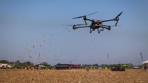
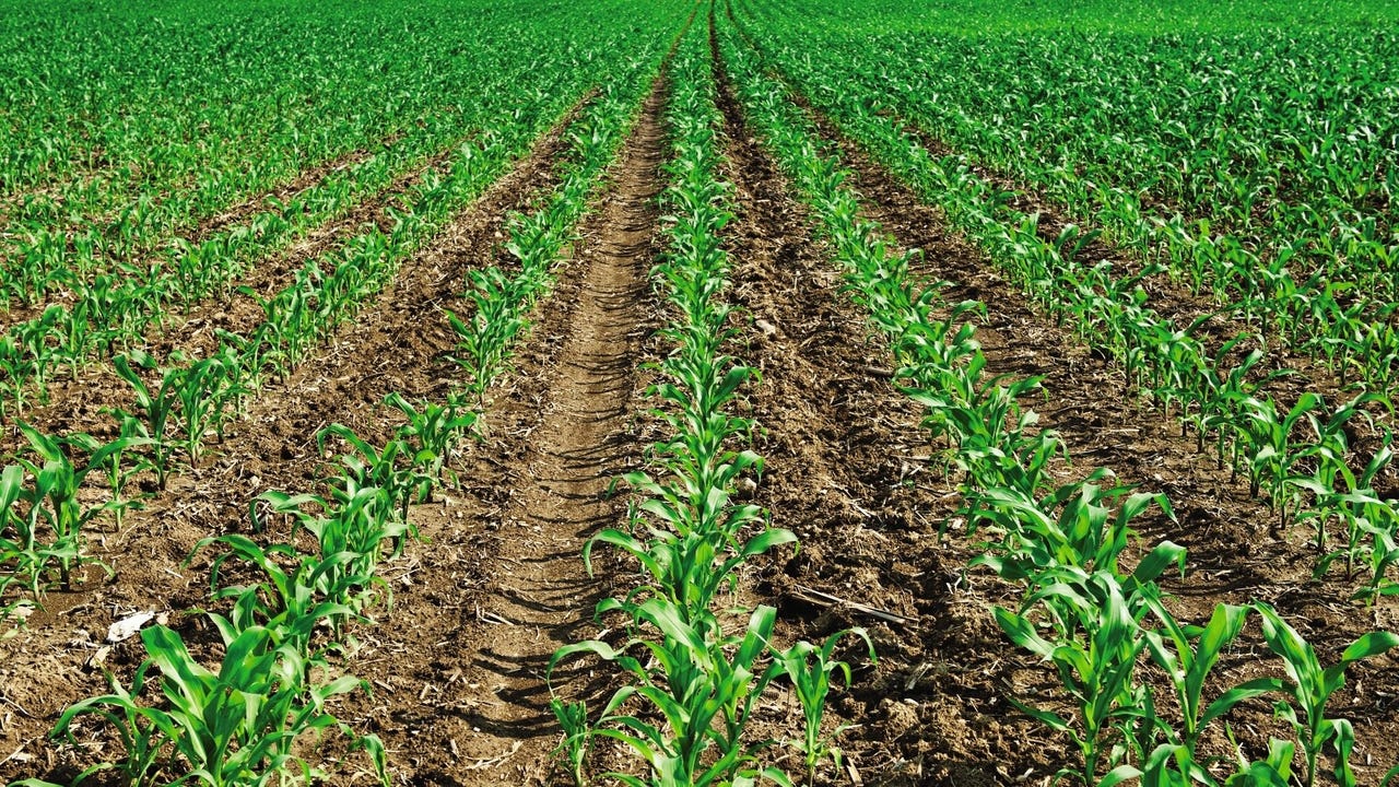
In farming, knowing your land is crucial. Traditional methods may leave gaps, but drones fill these voids with precision. With NDVI analysis, you can monitor crop health in real-time. Imagine spotting nutrient deficiencies before they become a problem, allowing you to make timely interventions. This proactive approach helps maximise yields, essential for farm mapping and yield optimisation.
Drones also assist with variable rate planning. By understanding your field’s needs at a granular level, you can apply resources like water and fertiliser more effectively. This not only saves money but also conserves resources, aligning with sustainable farming practices. It’s a win-win for both your pocket and the environment. For more on how aerial technology is supporting agriculture, see this USDA article.
Construction Projects and Monitoring
Construction projects are complex, often requiring frequent updates. Drones simplify this process with site surveys and construction progress monitoring. They quickly gather data, providing you with images and models that reflect the current state of your project. This clarity boosts communication among stakeholders, ensuring everyone is on the same page.
Drones also enable cut-and-fill analysis and volumetric analysis. With accurate measurements, you can better manage resources and schedule tasks, reducing delays and avoiding costly errors. Keeping your project on track has never been easier, and you can learn more about these benefits from this GisDrones article.
Inspections and Asset Management
For inspections, drones offer a safer, quicker alternative. Whether it’s a roof inspection, thermal drone inspection, or powerline inspection, drones can reach and assess hard-to-access areas. This not only increases safety but also reduces the time and cost typically involved with manual inspections.
Drones provide a detailed look at assets, helping you maintain them more effectively. Solar farm inspections and wind turbine inspections become less intrusive, allowing for regular checks without halting operations. The data captured supports proactive maintenance, reducing downtime and extending asset life. Read more about these advantages in this FlyGuys article.
Benefits of Drone Technology
The perks of using drones go beyond just stunning visuals. They offer tangible benefits in data collection, cost management, and decision-making.
Speed and Accuracy in Data Collection
Drones excel in gathering data swiftly and accurately. With RTK drone surveys and survey-grade accuracy, you obtain reliable data without delays. This speed means you can respond to issues promptly, preventing potential setbacks. The accuracy provided by drones ensures the data you rely on is correct, enhancing confidence in your decisions. To see how drones are enhancing construction projects, visit this UP42 blog.
Cost-Effectiveness and Resource Management
One of the biggest draws of drone technology is its cost-effectiveness. Traditional surveying requires significant manpower and equipment, which can be costly. Drones, however, streamline the process, reducing both labour and material costs.
With drones, you also manage resources better. By knowing the exact state of your project or field, you can allocate resources precisely where needed. This targeted approach avoids waste, saving money and helping meet sustainability goals.
Enhanced Decision-Making and Planning
Good planning is key in any project, and drones provide the data needed for informed decision-making. With access to GIS-ready data, you can craft detailed strategies that consider every variable. Whether you’re planning next year’s crops or a new building phase, drones give you the insights needed for success.
Drones challenge the old ways, proving that modern solutions offer better outcomes. By integrating drone data into your operations, you enhance planning and execution, leading to improved results.
Booking and Consultation Process
Ready to experience these benefits? Booking a consultation with Hoverscope is your first step towards improved project outcomes.
Tailored Solutions for Every Need
Every project is unique, and Hoverscope understands that. They offer customised solutions tailored to your specific needs. From progress reporting to stockpile measurement, they provide services designed to meet your objectives. Their client-centric approach ensures you get exactly what’s needed to succeed.
Contact and Consultation Details
Getting started is simple. Reach out to Hoverscope to discuss your needs, and their expert team will guide you through the options available. Whether it’s a small-scale farm map or a large construction site survey, they have the tools and expertise to deliver exceptional results.
Seasonal Scheduling and Packages
Hoverscope offers seasonal packages to fit your schedule and budget. By planning ahead, you ensure that your project remains on track all year round. Don’t wait any longer to see the difference drone technology can make in your operations.
Aerial imagery isn’t just a trend; it’s a game-changer for agriculture, construction, and inspections. By embracing this technology, you open the door to better data, smarter decisions, and ultimately, superior outcomes.