Precision from Above: Professional Drone Services for Farms, Construction and Inspections in Ontario
Most farm managers and construction teams still rely on outdated surveys that take days and cost too much. With drone services Ontario, you can cut that time drastically while gaining centimetre-level accuracy for every project. From agricultural drone mapping to 3D modelling with drones, Hoverscope delivers precise, compliant data that lets you make faster decisions with less risk. Keep reading to see how our aerial solutions bring clarity and control to your next project.
Read more about our work here.
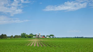
Precision Agriculture in Ontario

Precision agriculture is changing how farms operate, offering better data and insights. Let’s explore how drones can help your farm improve its efficiency and crop health.
High-Resolution Field Mapping
Start with understanding your fields like never before. Our drones capture detailed images that help you plan and manage effectively. These images are not just pretty pictures; they are tools for better decision-making.
-
Centimetre-level accuracy: Know every inch of your land. This level of detail helps you identify issues early.
-
Fast turnaround: You won’t have to wait long. Get your maps quickly and act without delay.
-
Cost-effective solutions: Save money compared to traditional methods.
With such clarity, you can tackle challenges head-on. No more guessing, just informed decisions.
Crop Monitoring and Assessment
Monitor your crops with precision. Drones provide insights that were once hard to get. They fly over your fields, capturing data that can change how you farm.
-
Health assessments: Spot problems before they spread. Early detection is key to saving crops.
-
Actionable data: Use imagery to make quick changes in your farming techniques.
Imagine seeing your crops in a new light. These insights lead to better yields and healthier crops.
Efficient Acreage Verification
Verify your land’s size with ease. Drones offer a reliable way to measure and assess your property.
-
Accurate measurements: Know exactly how much land you have. This is crucial for planning and management.
-
Streamlined reporting: Quickly generate the necessary documents for compliance and audits.
The longer you wait, the more you miss out on these advantages. Embrace this technology for better control over your farm.
Construction and Surveying with Drones
Drones don’t just help in agriculture. They are game changers in construction too. See how they can revolutionise your site operations.
Topographic Surveys and Site Models
Drones create detailed site models, providing a solid foundation for any project.
-
Speed and accuracy: Traditional surveys take time. Drones do it faster and with pinpoint accuracy.
-
Visual data: Get a clear picture of your site. Use these visuals for better planning and execution.
No more waiting around for results. Get the data you need when you need it.
Volumetric Analysis and Progress Tracking
Track your project’s progress efficiently. Drones make it easy to measure and document your site’s changes.
-
Real-time updates: Stay informed with up-to-date information. Make adjustments as needed.
-
Reduced risk: Accurate data means fewer mistakes and less rework.
Most construction managers struggle with outdated methods. Break free and see the difference drones can make.
As-Built Documentation and Reporting
Complete your projects with confidence. Drones offer reliable documentation and reporting.
-
Detailed records: Keep track of every stage of construction. This helps with compliance and future planning.
-
Easy sharing: Distribute data and insights effortlessly to stakeholders.
Why rely on old techniques? Modernise your approach with drone technology.
Comprehensive Inspection Services
Inspections are crucial for safety and maintenance. Drones provide a safer, more efficient way to conduct them.
Close Visual Inspections for Safety
Perform inspections without putting anyone at risk. Drones can access hard-to-reach areas with ease.
-
Safe operations: No need for scaffolding or harnesses. Drones handle the work safely.
-
Thorough checks: Get into every nook and cranny. Ensure nothing is overlooked.
Prioritise safety without compromising on detail. It’s a win-win situation.
Drone Inspections of Roofs and Towers
Inspect delicate structures with minimal disruption. Drones offer a bird’s-eye view, perfect for thorough assessments.
-
Minimal downtime: Inspections are quick, causing little to no disruption to operations.
-
Detailed imagery: High-resolution photos and videos provide clear insights.
Don’t let small issues turn into big problems. Regular checks with drones keep everything in top shape.
GIS-Ready Deliverables for Stakeholders
Deliver data that integrates seamlessly with Geographic Information Systems. This makes sharing and using information hassle-free.
-
Easy integration: Data fits right into your existing systems. It’s straightforward to use.
-
Stakeholder engagement: Keep everyone informed with comprehensive reports.
In a world where data is king, make sure you have the best tools and insights at your disposal.
By incorporating these drone services, you’re not just keeping up with technology. You’re leading the way in precision, efficiency, and safety.