Choosing between drone photography, orthomosaic mapping, or 3D modelling can feel overwhelming when each promises unique insights. Your project demands the right aerial deliverable to support accurate planning, monitoring, or reporting. This guide breaks down when to use each service—so you get precise data tailored to your needs. Enquire today to schedule a site assessment, review sample outputs, and secure your flight slot with Hoverscope.
Understanding Drone Photography
If you’re looking to capture stunning visuals from above, drone photography offers a unique perspective. It’s ideal for projects where visual storytelling is key.
Benefits of Drone Photography
Drone photography offers you a bird’s-eye view that traditional methods can’t match. You get high-quality images and videos, perfect for showcasing properties, events, and landscapes. With drones, you can snap images from angles that would otherwise be impossible. This capability provides you with dynamic content that stands out. For instance, when marketing a property, eye-catching photos can boost interest. Plus, drones can cover large areas quickly, saving you time and effort compared to ground photography.
Ideal Use Cases for Photography
Think of drone photography when you need to highlight a property’s layout or capture an event from above. It’s perfect for real estate, giving potential buyers a clear view of the property’s surroundings. Event planners can use it to show the scale and excitement of gatherings. It’s also great for tourism, allowing you to promote destinations with captivating images. Imagine showcasing a festival with vibrant aerial shots, drawing more attendees next year.
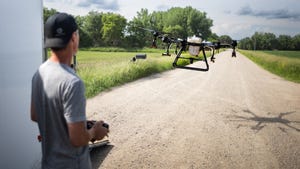
Drone Photography in Ontario
In Ontario, drone photography has gained traction across various sectors. From real estate to tourism, businesses rely on it for compelling visuals. You can capture Ontario’s stunning landscapes, from urban skylines to rolling farmlands. By using drone photography, you tap into a growing trend that enhances how you present your projects. The province’s diverse settings make it an ideal backdrop, ensuring your visuals are both unique and memorable.
Mapping with Drones

When you need detailed insights and accuracy, drone mapping steps in. It’s your go-to for precise data that informs decision-making.
Orthomosaic Mapping Explained
Orthomosaic mapping provides you with a comprehensive view of a site. Unlike regular images, these maps stitch together multiple shots, offering high detail. They’re perfect for analysing large areas like farms or construction sites. You get a true-to-scale representation, aiding in accurate measurements. For example, in agriculture, you can assess crop health with precision. These maps are not just images; they are powerful tools for planning and monitoring.
Construction Progress Mapping
In construction, keeping track of progress is vital. Drone mapping offers you regular updates with minimal disruption. By flying over the site, drones capture current conditions, allowing you to monitor changes efficiently. This approach ensures you stay on top of timelines and identify potential issues early. The data you receive helps in coordinating teams and resources effectively, reducing delays and enhancing productivity.
Topographic Survey by Drone
Traditional topographic surveys can be time-consuming and costly. Drones revolutionise this by offering quick and accurate alternatives. With drones, you can map terrains swiftly, collecting data that aids in planning and development. This method is particularly beneficial for large or inaccessible areas. The result is a detailed map that informs your project, ensuring you make informed decisions from the outset.
Exploring 3D Modelling
For projects where depth and detail are crucial, 3D modelling with drones provides you with an interactive representation.
3D Modelling Drone Techniques
Drones use advanced techniques to create 3D models, offering a complete view of an area or structure. These models are invaluable in fields like architecture and construction. You can explore designs before they’re built, making adjustments that save time and cost. For example, architects can use these models to visualise a building’s integration into its environment. The level of detail and accuracy enhances your project planning and presentations.
Photogrammetry Point Cloud Use
Photogrammetry translates images into data-rich point clouds. You gain a detailed 3D representation, useful for various applications. This technique is particularly effective in surveying and construction. You can analyse structures, check for compliance, and plan renovations with confidence. The detail captured helps in creating accurate models that guide your projects. Learn more about photogrammetry applications.
Benefits of Digital Surface and Terrain Models (DSM/DTM)
Digital Surface Models (DSM) and Digital Terrain Models (DTM) provide you with insights into the earth’s surface. These models are essential for planning and analysis, offering a clear understanding of landscapes. In urban planning, they help in assessing how new developments interact with existing structures. For environmental studies, they offer data on terrain changes. The precision of these models ensures you have the information needed to make informed decisions. Discover how DSM and DTM can impact your projects by exploring further resources.
By considering the unique benefits and applications of drone photography, mapping, and 3D modelling, you can choose the right solution for your needs. Each offers distinct advantages, helping you achieve your project goals with precision and creativity.