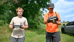
A Practical Guide to Choosing Between Aerial Photography, Mapping, 3D Modelling and Inspections
Choosing the right drone service can feel overwhelming when options like aerial photography, mapping, 3D modelling, and inspections each promise unique benefits. If you’re aiming for clear visual storytelling, precise maps, accurate 3D data, or thorough condition assessments, the decision shapes your entire project’s success. This guide breaks down how Ontario drone services match your specific needs, helping you select the best approach with confidence.
Choosing the Right Service
When it comes to selecting the perfect drone service, understanding your needs is crucial. Let’s dive deeper into how you can align your objectives with the right options.
Understanding Your Objective
First, consider what you want to achieve. Are you looking to tell a captivating story with images, or do you need precise data for construction planning? Knowing your main goal is the first step. For instance, if your focus is on visual storytelling, aerial photography might be your best bet. If accurate data is more important, then mapping and modelling services become essential.
Evaluating Project Requirements
Every project is unique, and so are its needs. Identify the specific requirements of your project. Do you need detailed imagery or comprehensive data? Projects like construction progress mapping or agricultural drone mapping require different approaches. Evaluate your project’s scope to determine the best service fit. Remember, the right choice will not only meet but exceed your expectations.
Matching Services to Goals
Now it’s time to match your objectives with the right services. If your goal is to capture stunning visuals across Ontario, aerial photography is ideal. For detailed maps and 3D models, consider drone mapping and modelling services. Each service offers specific benefits, so choose the one that aligns with your goals to ensure successful outcomes.
Exploring Aerial Photography
Aerial photography opens a world of possibilities. From capturing breathtaking landscapes to providing a new vantage point for your projects, let’s explore how this service can be a game-changer.
Visual Storytelling Techniques
Aerial photography isn’t just about taking pictures from above. It’s about creating a narrative. By using techniques such as panoramic shots and time-lapse photography, you can tell a story that resonates. This approach captivates your audience and provides a unique perspective that ground-level photography can’t offer.
Aerial Photography in Ontario
Ontario’s diverse landscapes provide a stunning backdrop for aerial photography. Whether it’s capturing the vibrant colours of autumn or the serene beauty of a winter landscape, the opportunities are endless. Drone photography offers a chance to see Ontario like never before, showcasing its beauty from above and providing compelling images for various projects.
Key Benefits and Applications
There are numerous benefits to aerial photography. It provides high-resolution images that can be used for real estate, marketing, and event coverage. The applications are vast, ranging from promotional content to detailed site analysis. With aerial photography, you gain a new perspective that can enhance any project.
Mapping, Modelling, and Inspections
While aerial photography captures stunning visuals, mapping and modelling offer precision and detail. Let’s delve into the essentials of these services.
Drone Mapping Ontario Essentials
Mapping with drones involves creating detailed maps and orthomosaics. This service is essential for projects requiring accurate ground representation. Whether it’s for construction planning or agricultural management, drone mapping provides the precise data needed for effective decision-making.
3D Modelling and Photogrammetry
Creating a 3D model involves capturing multiple images to build an accurate representation of a site. This method is invaluable for volumetric calculations and as-built models. It gives you a comprehensive view and allows for precise planning and analysis. Discover more about the differences between LiDAR and photogrammetry here.
Effective Drone Inspections Techniques
Inspections with drones ensure safety and efficiency. They provide a safe way to assess hard-to-reach areas like roofs or facades. Using drones for inspections saves time and reduces risk, making it a preferred choice for many industries. Learn more about the techniques involved in aerial inspections for construction here.
In conclusion, selecting the right drone service depends on your specific needs. Whether it’s stunning aerial photography or precise mapping, understanding your objectives and project requirements will guide you to the perfect choice. Hoverscope Aerial Imaging is here to assist with advanced technology and client-focused solutions for all your projects across Ontario.