Forget the guesswork that comes with aerial data collection. You need an aerial imaging workflow that’s fully compliant with Transport Canada and delivers survey-grade accuracy you can trust. From initial take-off through precise photogrammetry processing and rigorous QA/QC, Hoverscope’s approach turns complex sites into clear, decision-ready maps and models. Keep reading to see how we bring unmatched drone mapping accuracy to your projects across Ontario. For more insights, visit this link.
Aerial Imaging Workflow Basics

Dive into the essentials of Hoverscope’s aerial imaging workflow, where compliance and precision meet innovation.
Understanding Compliance and Accuracy
To ensure you’re getting top-quality data, it’s crucial to follow strict regulations. Compliance with Transport Canada rules isn’t just about ticking boxes. It ensures your projects run smoothly without legal hiccups. This commitment guarantees that each aerial mission is both legal and reliable. Accuracy, on the other hand, is about providing data that’s spot-on. By using advanced technology, we ensure every map is a true reflection of your site. So, you can make decisions based on facts, not guesses.
Survey-Grade Data Collection Techniques
Collecting data with precision starts with the right techniques. We employ methods that capture every detail. Using survey-grade RTK/PPK, we enhance accuracy by correcting GPS errors. This technology ensures that your maps and models reflect the real world. Additionally, ground control points (GCPs) further refine this accuracy, providing a solid foundation for any project. With these tools, what you see is truly what you have. You can explore more about these methods on McKissock’s blog.
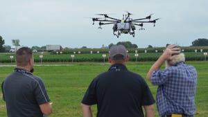
Risk Mitigation in Drone Operations
Safety is at the core of every flight. Risk mitigation involves careful planning and execution. Before any mission, we conduct a thorough risk assessment and method statement (RAMS). This process identifies potential hazards and outlines steps to manage them. Our advanced operations drone pilots are trained to handle unexpected situations, ensuring your project is safe from start to finish. With these precautions, you can trust that your data collection is in capable hands.
Delivering Decision-Ready Data
Transitioning from raw data to actionable insights requires a meticulous process. Here’s how we do it.
Georeferencing and QA/QC Processes
Converting aerial images into useful data begins with georeferencing. By aligning images with real-world coordinates, we ensure every pixel counts. This step is followed by rigorous QA/QC processes, which guarantee data quality. Each image undergoes checks to confirm accuracy, providing you with reliable information every time. Through these processes, you receive data that’s not only precise but also ready to inform your decisions.
Orthomosaic Mapping and 3D Modelling
Creating orthomosaic maps and 3D models transforms how you see your site. These detailed representations offer a comprehensive view, making it easier to plan and execute projects. With orthomosaic mapping, you get a bird’s-eye view that’s as accurate as being on-site. 3D models take it further, offering depth and perspective. This technology is pivotal in both planning and monitoring, ensuring all aspects are covered. For more on this process, check out this guide on construction mapping workflow.
GIS-Ready Deliverables and Reports
Once processed, data is transformed into GIS-ready GeoTIFF deliverables. These files integrate seamlessly into your existing systems. Reports generated from this data are comprehensive, offering insights at a glance. Whether it’s contour mapping or volumetric measurements, the information provided is practical and actionable. By choosing our services, you receive data that’s not only accurate but also easy to use and implement in your projects.
Expert Services for Your Industry
Tailored solutions are key to meeting industry-specific needs. Discover how our services can transform your operations.
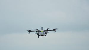
Advanced Agriculture Imaging Solutions
For farmers and agronomists, precise data is crucial. Our multispectral drone surveys provide insights into crop health, using NDVI mapping to monitor growth. These tools enable early detection of issues, allowing for timely interventions. This data-driven approach maximizes yield potential while minimizing resource usage. With our services, precision farming becomes a reality, enhancing productivity and sustainability.
Construction and Surveying Precision
In construction and surveying, accuracy is non-negotiable. Our drones offer as-built verification, ensuring plans align with reality. By using volumetric measurements by UAV, we provide precise calculations of material needs. This accuracy streamlines operations, reducing waste and enhancing efficiency. The ability to monitor progress with clarity ensures projects are completed on time and within budget. Learn more about volumetric accuracy at Eagleview’s blog.
Personalised Consultations and Bookings
Every project is unique. That’s why we offer customised consultations to understand your specific needs. Our team works closely with you, offering guidance and insights tailored to your goals. Booking is easy and flexible, ensuring our services fit seamlessly into your schedule. By choosing us, you gain a partner committed to your success, ready to provide the support you need at every step.