How Drone Technology is Revolutionising Agricultural Crop Monitoring
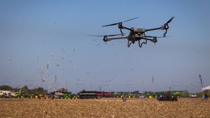
Traditional crop monitoring can leave you guessing, spending hours walking fields with limited insight. Drone crop monitoring changes that by delivering detailed, timely data across your entire farm in a fraction of the time. With Hoverscope’s agricultural drone mapping Ontario services, you gain precise orthomosaic farm maps, multispectral drone imaging, and crop health assessment UAV tools that sharpen your decisions and protect your yield. Ready to see your fields with absolute clarity? Learn more about how drones are revolutionising agriculture practices.
Drone Crop Monitoring Benefits
Drone crop monitoring offers numerous advantages that can redefine traditional farming methods. By employing these aerial tools, you gain speed, safety, and accuracy in your crop assessments.
Faster Insights with UAVs
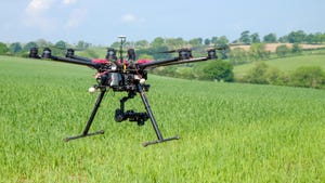
Imagine saving countless hours by letting drones do the heavy lifting. Drones efficiently survey large expanses in minutes, providing you with quick insights. This means no more long days trudging through fields. Instead, you receive immediate data from your entire farm.
These rapid assessments help you make timely decisions. They alert you to potential issues before they escalate. You can spot pest infestations or nutrient deficiencies early. This proactive approach means healthier crops and better yields without delay.
Drones also offer real-time data collection. This data is crucial for precision farming with UAVs. Farmers can monitor changes and act fast, ensuring optimum crop health. Explore more on how UAVs are transforming crop monitoring.
Safer Crop Assessments
Safety is another significant benefit of using drones. Traditional methods can expose you to harsh weather or difficult terrain. Drones eliminate these risks by handling the tough tasks for you.
Using drones reduces human error. They provide a bird’s-eye view that identifies hazards you might miss on foot. This technology ensures a thorough inspection without personal risk. It protects both you and your crops.
Furthermore, drones can access hard-to-reach areas easily. This capability means no section of your farm is overlooked. You gain comprehensive insights into every part of your land.
More Accurate Data Collection
Accuracy is key in farming, and drones excel here. They collect data with unmatched precision. This precision is crucial for tasks like plant stand counts by drone.
Drones offer detailed imagery that reveals what the naked eye can’t see. For instance, they can identify subtle changes in plant health. This level of detail aids in making informed decisions.
The data collected is not only accurate but also easy to analyse. Advanced software processes this data into actionable insights. You can visualise your farm’s condition clearly and plan your next steps effectively. Discover the impact of accurate data collection on farming.
Advanced UAV Technologies
Harnessing the latest UAV technologies can elevate your farming practices. These tools are designed to provide precise mapping and analytics, ensuring you have the best information at your fingertips.
Precision Mapping and Analytics
Precision mapping is at the core of effective farm management. Drones equipped with RTK drone mapping capabilities offer this advantage. They create precise orthomosaic farm maps that are essential for detailed analysis.
With these maps, you can assess your land’s topography and plan your planting strategy. They help in understanding drainage and elevation modelling. This information is vital for optimising irrigation and ensuring crops receive adequate water.
These maps also assist in variable rate application maps. You can apply fertilisers or pesticides exactly where needed, reducing waste and enhancing efficiency. Precision mapping ensures every inch of your farm is utilised effectively.
Multispectral Drone Imaging
Multispectral drone imaging opens a new world of insights. These drones capture light beyond what we can see. They reveal hidden data about your crops’ health and soil conditions.
This technology helps in creating detailed NDVI drone surveys. NDVI, or Normalised Difference Vegetation Index, is a powerful tool. It shows plant health, allowing you to detect stress early.
Multispectral data is also invaluable for time-series crop monitoring. You can track changes over time and adjust your practices accordingly. This ongoing monitoring ensures that you maintain optimal growing conditions throughout the season. Learn about the benefits of multispectral imaging in agriculture.
Thermal Drone Leak Detection
Thermal drones add another layer of utility. These drones are essential for thermal drone irrigation leak detection. They identify leaks that might go unnoticed otherwise.
By detecting leaks early, you save water and preserve resources. This detection helps maintain uniform irrigation, ensuring all crops receive the right amount of water. Thermal imaging is precise, highlighting even minor temperature differences.
Using thermal drones is also cost-effective. They prevent potential losses due to water wastage, improving your farm’s overall efficiency. This technology supports sustainable farming practices, benefiting both you and the environment.
Engaging with Hoverscope Services

Hoverscope not only provides advanced technology but also offers tailored services to meet your unique needs. Our goal is to support your success through customised solutions.
Tailored Field Trials and Packages
We understand every farm is different. That’s why we offer tailored field trials and packages. These are designed to fit your specific requirements and goals.
Our team collaborates closely with you. We assess your needs and recommend the best solutions. This personalised approach ensures you get the maximum benefit from our services.
Our packages include everything from basic surveys to comprehensive monitoring plans. Whatever your needs, we have a solution that fits. Most farms realise substantial benefits within the first season of using our services.
NDVI and Time-Series Monitoring
Our NDVI and time-series monitoring services keep you informed. With regular updates, you can track your crops’ progress and make informed decisions.
These services are crucial for maintaining crop health. They alert you to changes, allowing you to address issues promptly. This proactive approach leads to healthier yields and enhanced productivity.
Time-series monitoring gives you a historical overview. You can see trends and patterns, helping refine your strategies. This insight is invaluable for long-term planning and success. Understand how NDVI monitoring benefits agriculture.
Transport Canada Compliant Operations
Safety and compliance are paramount in our operations. We adhere strictly to Transport Canada regulations, ensuring safe and legal drone use.
Compliance gives you peace of mind. You can trust that our operations are conducted safely and to the highest standards. Our commitment to safety protects your farm and ensures uninterrupted service.
By choosing Hoverscope, you partner with a company dedicated to excellence and integrity. We are not just a service provider but a trusted partner in your farming journey. Let us help you achieve your agricultural goals with confidence.