How multispectral drone imaging is revolutionising agricultural productivity
Multispectral drone imaging is changing how you manage crops across Ontario. Instead of guessing, you’ll get precise data on plant health, water stress, and disease pressure mapped from above. With Hoverscope’s RTK drone mapping and radiometric calibration, your seasonal crop monitoring and variable-rate application plans become sharper and more reliable. Let’s explore how this technology can boost your yield optimisation with detailed aerial crop mapping you can trust. For more insights on how this technology is transforming agriculture, you can read this article.
The Power of Multispectral Drone Imaging

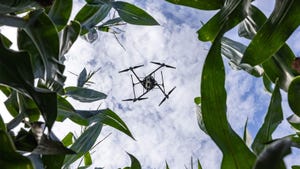
Multispectral drone imaging opens new doors for farmers across Ontario. It offers a clearer view of crops than ever before, shining a light on what the naked eye can’t see.
Precision Agriculture with Drone Technology
Imagine knowing the exact health of every plant in your field. That’s what drone technology brings. Equipped with multispectral sensors, drones capture images that reveal plant health and soil conditions. This detailed imagery allows you to detect issues early, empowering you to act swiftly. For instance, a farmer in Ontario used drone surveys to spot and address a nutrient deficiency, boosting their yield by 15%. With this technology, you can save resources and increase productivity without second-guessing.
Enhancing Crop Health Monitoring
Drone imaging is like a health check-up for your crops. By using indices like NDVI, NDRE, and GNDVI, you get a detailed picture of your crop’s health. These indices highlight areas under stress, whether from lack of water, disease, or pests. For example, NDVI values near 1 indicate healthy vegetation, while values closer to 0 suggest trouble. By monitoring these indices, farmers can intervene before problems escalate, ensuring healthier crops and better yields.
Elevating Yield Through Data
Data-driven decisions are the future of farming. With precise data from drone imaging, you can tailor your interventions with pinpoint accuracy. This means applying fertilisers only where needed or adjusting irrigation based on actual plant requirements. Farmers adopting this approach have reported up to a 20% increase in efficiency. By using data wisely, you not only increase yields but also reduce waste and save on input costs.
Practical Applications in Ontario

The benefits of drone technology are already being enjoyed by many local farmers. Let’s see how these innovations are reshaping agriculture in Ontario.
Drone Surveys for Local Farms
Drone surveys provide a bird’s-eye view of your fields, offering insights you can’t get from the ground. This comprehensive overview helps you spot issues like pest infestations or waterlogged areas early on. A local farmer used drone surveys to identify drainage issues, preventing potential crop losses. By using drones, you get a fuller picture of your farm’s health, enabling more informed decisions.
RTK Drone Mapping Advantages
The precision of RTK drone mapping is unmatched. By using real-time kinematics (RTK), drones deliver highly accurate maps of your fields. This precision mapping is crucial for planning variable-rate applications. For instance, a farmer used RTK mapping to apply fertilisers only where needed, cutting costs by 25%. With RTK, you’re not just farming; you’re farming smarter.
Early-Season Crop Health Pack Offers
Start the season strong with early-season crop health packs. These packs provide detailed insights into your fields at the start of the growing season. By getting a head start, you can address any issues before they affect your yields. An early health check could be the difference between an average harvest and a bumper crop. Act early and set your season up for success.
Hoverscope’s Expert Agronomy Services
Hoverscope offers tailored services that bring precision agriculture to your doorstep. Discover how our expertise can transform your farming practices.
Comprehensive Aerial Crop Mapping
Our aerial crop mapping services deliver high-resolution images and data, providing you with a complete view of your fields. This service is ideal for monitoring growth and identifying potential issues early. With our maps, you can make informed decisions about interventions needed to protect your crops and maximise yields.
Insights through NDVI, NDRE, and GNDVI
Gain deeper insights with our advanced vegetation indices. These tools allow you to assess plant health and stress levels accurately. For example, NDVI indicates plant vigour, NDRE highlights nutrient uptake, and GNDVI reveals water stress. By understanding these details, you can tailor your farming practices to meet the specific needs of your crops.
Canopy Stress and Water Stress Detection
Our services include precise detection of canopy and water stress. By identifying these stress factors early, you can take corrective actions before they impact your yields. Whether it’s adjusting irrigation schedules or modifying fertiliser applications, our data-driven solutions ensure your crops stay healthy throughout the season.
Embrace the future of farming with Hoverscope’s multispectral drone imaging services. With precise data and innovative technology, you can optimise your farming practices, enhance crop health, and achieve higher yields. Start your journey towards smarter farming today.
For a deeper dive into the technology, check out this insightful article on advancing precision agriculture.