Spring planning demands precise data, but gathering it on foot can slow you down. Aerial mapping cuts through the guesswork, delivering detailed orthomosaic maps, NDVI analysis, and GIS-ready data faster than traditional surveys. With Hoverscope’s drone services, your farm or construction site gets survey grade accuracy and timely insights to shape smarter decisions this season. Ready to see how it fits your spring strategy? Explore more about automated field mapping advantages here.
Precision with Aerial Mapping
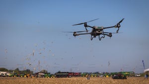
Spring brings new opportunities in agriculture and construction. Using aerial mapping, you can quickly gather the data needed to make informed decisions. This approach ensures you start the season with confidence.
Enhancing Spring Planning
Aerial mapping offers a fast and accurate way to assess your land’s needs. You get detailed visuals that help in planning effectively. Whether it’s for crops or construction, having precise data aids in better preparation and execution.
Benefits of RTK Drone Survey
RTK drone surveys provide exceptional accuracy. These drones capture data with centimetre-level precision, ensuring your maps and models are spot-on. You’ll save time and resources by avoiding the inaccuracies that come with traditional methods. Plus, with the detailed insights provided, you can address potential issues before they escalate.
Transport Canada Compliant Operations
Safety and compliance are vital. Hoverscope ensures all operations meet Transport Canada’s strict regulations. This compliance guarantees not only safe flights but also reliable data collection. With Hoverscope, you can trust that every aerial survey is conducted with the highest standards of safety and precision.
Agricultural Mapping Techniques

Aerial mapping isn’t just about images; it’s about transforming how you manage your land. By integrating these techniques, you unlock the full potential of your farm.
NDVI Analysis and Crop Monitoring
NDVI analysis is a game-changer for crop health. This method allows you to see what your eyes can’t, revealing plant health through spectral imaging. By using NDVI, you can pinpoint areas needing attention. This proactive approach helps in boosting yields and maintaining healthy crops.
Soil Variability and Field Boundary Mapping
Understanding soil variability is key to effective farm management. Aerial mapping provides detailed soil maps, highlighting differences across your fields. With this information, you can plan precise interventions, ensuring every part of your field gets exactly what it needs. Additionally, defining field boundaries becomes easier, reducing disputes and enhancing management.
Contour Maps for Drainage Planning
Water management is crucial. Contour maps offer a clear view of your land’s topography, helping you design effective drainage systems. By managing water flow better, you prevent erosion and optimise water use. This technique is especially beneficial in areas prone to flooding or waterlogging.
Construction and Earthworks Solutions
Aerial mapping isn’t limited to agriculture; it revolutionises construction too. From site analysis to progress tracking, the benefits are clear.
Topographic Survey and 3D Modelling
Construction projects rely on accurate site data. Topographic surveys provide that data in detail. Using 3D modelling, you get a comprehensive view of the site, aiding in planning and execution. With these models, you can visualise changes and plan accordingly, reducing errors and ensuring project success.
Cut and Fill Volumes Assessment
Understanding your site’s cut and fill volumes is essential for efficient earthworks. Aerial mapping provides precise measurements, helping you manage resources better. You’ll reduce waste and optimise material use, leading to cost savings and a more sustainable approach to construction.
Progress Monitoring and BIM Integration
Tracking project progress is easier with aerial mapping. You get regular updates through detailed images and models, allowing for better management and timely interventions. Integrating this data with BIM systems enhances planning and execution, ensuring your project stays on track.
Incorporating aerial mapping into your spring strategy brings clarity, efficiency, and confidence. Whether you’re managing a farm or a construction site, the advantages are undeniable. With precise data at your fingertips, you’re empowered to make informed decisions that drive success.